North Downs Way - Merstham to Guildford (★★★★☆)
Today is the third of four days spent walking along the North Downs Way - and today I am walking from Merstham to Guildford, as part of a longer walk from Rochester to Farnham. On the previous day I had walked from Otford to Merstham.
Having stayed overnight in Redhill, and making use of the frequent train links up from Redhill (you can just tap in and out at these train stations), it was a quick trip up from Redhill back onto the North Downs Way.
 |
| The latest version of the route map at Merstham |
The proximity of the train station to the route of the North Downs Way is very good, and after heading through the older parts of Merstham, the path heads out across the golf course and back into the countryside once again.
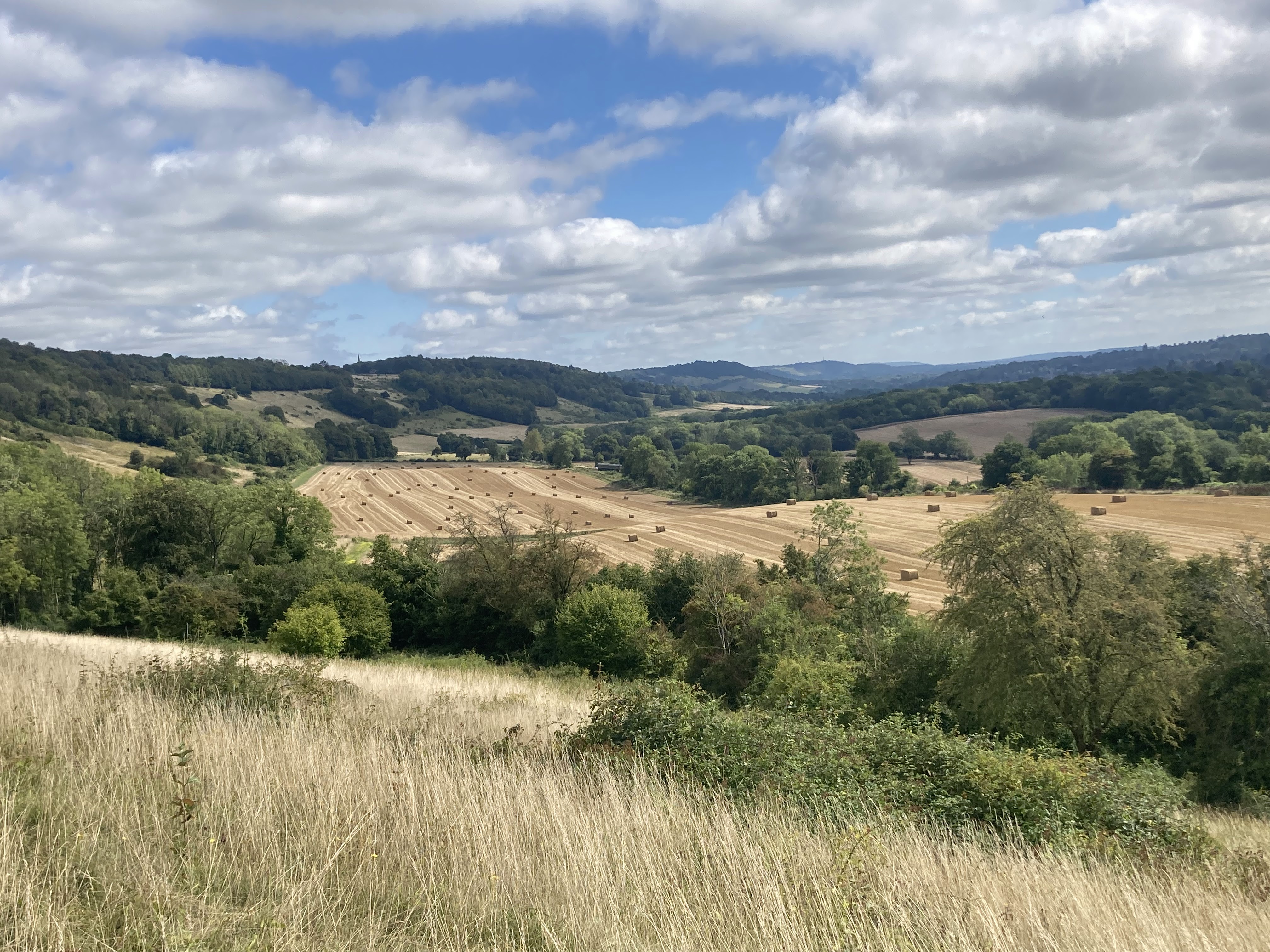
 |
| The view from the golf course - one of the more pleasant golf courses to cross |
From here the path bends round to the village of Gatton, where it passes Gatton Hall School (or Royal Alexandra & Albert School - both names seem to be used).
The school here is a public boarding school and commands fees of £7,000 a term to cover the costs of boarding, but is actually a state school - with the state covering the normal costs of teaching, and making this school a fairly cost effective way of getting rid of your children (hurrah!).
From here the path bend right and then left, heading on through Gatton Park, which turns out to be a very attractive area of woodland that leads round to Gatton Hill.
At Gatton Hill we find a popular cafe and a full array of facilities, but with it being so early in the day there is no real benefit to us of these being here (if you're walking with me you don't have permission to stop for a morning coffee - there is walking to be done).
On my way past Gatton Hill I took in the views along the front and then realised that I needed to track back a bit to cross over the A217 via Reigate Hill Footbridge (according to a little plaque this was the earliest reinforced concrete footbridge in the country - and for a concrete bridge it is actually fairly pretty).
Passing over the fairly static road (full of commuters) below, this bridge takes us on towards Reigate Hill, where the main point of interest is the old fort (built in 1898), which whilst quite industrial looking is enough of a curiosity to be worth a quick look around.
From here it is only a short walk before we come across our next point of interest - at the site of an airplane crash (two small seats mark the spot), before we head out of the trees onto Colley Hill - which is a very pretty grassy ridge with plentiful attractive views.
 |
| The pavilion at Colley Hill - it is not leaning, I was somehow leaning |
 |
| Colley Hill |
This is a real high spot of the walk so far - and whilst a camera cannot really capture the panoramic nature of the views, the two pictures do hopefully give a bit of a feel for this spot.
Here we are able to do what we came to the North Downs Way to do - and we spend this next section walking along the ridge line, and looking out across the green countryside below.
As we walk along the ridge we are still incredibly close to the M25, and you will see it's proximity on the map, but on this occasion the placement of the motorway has been well done, and it has no real impact on my walk past.
After an enjoyable stroll along this open ridge, we eventually head into a more wooded spot at the end of Colley Hill, and very soon after start to head down off the ridge - via a long descent (there were joggers heading the other way, oblivious to the fact that it was hard enough just walking downhill).
Once at the base of the ridge we find ourselves in a bit of a no-mans land - following the Pilgrim's Way trackway, and as we walk along this track bordered to the right by trees, and to the left by fields, it becomes clear that we will have this section of path to ourselves.
Having come down off the ridge, this section doesn't have the same views as we had before, but it is a pleasant enough walk - and we do indeed only pass one further person before we come out at a road, which we briefly follow.
This is a busy road, but a path has been installed that runs parallel which does help proceedings - and if you are looking for a spot to get on and off the path, Betchworth train station is only a very short walk down the road from here.
But instead we cut off the road, and head into the outskirts of Box Hill Country Park - and what follows is a wooded section that includes quite a steep climb back up onto the ridge above.
There isn't much initial reward for the effort expended on this climb, but as we continue on, the views do open out - with the first properly good view coming as we look out towards Brockham, on our way past.
These views only last so long before we head back into the trees - but soon we get compensation for this as we head back out onto the ridge at Box Hill itself.
 |
| Looking at Dorking from Box Hill - the path will go round the vineyard on the right |
Box Hill has achieved a level of iconic status ever since it featured in the Olympic cycling races - with the zigzag climb officially the world's most popular cycle climb on Strava.
For cyclists this route up Box Hill is in all honesty quite an easy one, as the switchbacks reduce the gradient to a very manageable level, but for us walkers Box Hill is typically climbed via a set of fairly steep and never-ending steps.
We will be going down rather than up - but there is no rush, for the views from here are very good - and on the way down I lose count of the steps as I close in on about one million in total.
At the base of the steps we reach the River Mole, and here you have two options in term of what you do next - you can turn right and be boring by going over the footbridge, or you can live a little and take the more exciting route over the stepping stones.
While crossing the stones, I did find that they are built for people with bigger legs than mine, but it is not very deep, and there was already a child splashing about in the water - so it is hardly dangerous (it would merely be hugely embarrassing to fall in).
For those who are concerned about a fall, the best advice I can give would be to imagine falling in, and then imagine everyone laughing at you - and then with every step you will keep this image in your mind. This won't relax you, but it will at least give everyone else a laugh as you get increasingly concerned about a potential fall.
 |
| The stepping stones |
But once safely across there is a more genuine hazard ahead, at a busy road crossing.
The safest thing to do is to turn right and follow the official route up to a subway just past the next road crossing to the north - in total this adds just over half a mile of extra walking as you head up and back, but it will guarantee you get across safely.
But since it isn't very busy I cross here, scuttling to the grass in the middle, and then repeating the procedure on the far side. If you make it to the middle but can't make it across on the far side you might end up getting embarrassingly stuck in the middle, but I usually find the eventually one kind soul will slow down enough to help you across.
 |
| The next route map - getting closer to Farnham now |
Having made it across without getting run over, my next job is to head to the crossroads in the path near Westhumble train station, where I will meet up with my Dad - who will be joining me for the rest of the walk to Guildford (I did grow up in Guildford after all).
I'm running very slightly late at this point, having opted to make the most of the views at Box Hill in preference to arriving on time - but I'm only very slightly behind schedule, and the meet up is completed without much fuss.
From here we continue on through a wooded section of the trail, which winds round and up through Aschombe Wood, before releasing us at the top of the ridge above Denbies vineyard - with views out across Dorking below.
Here we manage to become minor celebrities when the guided tour heads up from the vineyard (a land rover struggling up the hill with two seated wagons behind).
After the tour turns round, and heads back down the hill, we get filmed on about thirty camera phones, as the sheer shock of people making it up the hill without the use of petrol becomes too overwhelming to not be captured. All in all, this was an incredible moment for those visitors - with the sight of us almost certainly making the cost of the tour seem worthwhile.
But we continue on, unaided by petrol power, and try to stay grounded despite our new celebrity status. Soon we arrive at Ranmore Common and decide to stop at one of the benches by Ranmore Church, and as an extra bonus I have been brought some baked goods which I can now break into.
 |
| Ranmore Church |
There is a lot to watch as we sit here, with a mix of cyclists parking up and getting out their bikes and walkers coming down from the grounds of Polesden Lacey.
I am now firmly back in familiar country, as this is a regular spot to visit when I pop home - and so we head off on familiar routes as we cross over the road, and onto the edge of the ridge on the far side.
This gets us back onto some ridge walking, but this only last so long before we head into the trees once again.
Further on through the trees we hit a crossroads in the path - and for those interested in doing more walking in this area, there are nice areas to walk both to the north and south from this crossroads.
If you were to head north, this would take you on past Yewtree Farm, from which you can head north along a tree lined raised path, and through the outer grounds of Polesden Lacey to Chalkpit Lane. From here you can get up into Little Bookham, and it is a further 1 mile up past the houses to Bookham train station.
Alternatively if you were to head south you would drop off the ridge, over the trainline, and can join up with the Greensand Way to either head on to Leith Hill or back into Dorking. The walk into Leith Hill is pretty one but with slightly limited access to public transport at that far end.
Today though, we are continuing on along the North Downs Way - heading on through the woods that cover the ridge, before we get released from the trees just past Pickett's Hole.
Here we drop off the ridge for another break at a bench just slightly down the ridge, and I finish off the rest of the food I had been provided with.
 |
| White Downs on a previous visit slightly later in the year (looking left) |
 |
| White Downs on this visit (looking right) |
I have used a photo from an earlier visit here (the top one) as it is a nice photo that really shows off this spot, but after a bit of a rest we head back up the ridge, and return to the North Downs Way.
The next section is no longer wooded, and we are once again walking along the front of the ridge, and taking in the views of the valley below. And this is a lovely stretch of the path, and my favorite walk when I pop home.
After following the ridge for a bit longer, it is time to head back into the trees, passing into the woods at Hackhurst Downs - and this wooded section continues on through Netley Heath, Netley Park, West Hanger, Chantry Wood and on along the old Drove Road to Newlands Corner.
This is a long stretch of the rain to condense down into one paragraph, but in reality this stretch is quite repetitive, as it is a long spell spent walking through these managed woods.
For those who are not too particular about following the official route, the nicer thing to do is to head down Beggars Lane at Hackhurst Downs, and then use the footpaths to cut into the pretty village of Shere (most known for featuring in The Holiday film). Here you will additionally be able to get supplies and even an ice cream at the village shop.
It is Shere madness in my mind (see what I did there?) that the North Downs Way doesn't pass through Shere, as it does give a very close feel to the run through and past the villages between Maidstone and Ashford - and combined with the church at St Martha's would inject a Pilgrim's Way feel to this section of walking.
On this alternate route, you can head through Shere and then on via the Fox Way - and then either use that to head back up to the North Downs Way above Silent Pool, or (as I would recommend) stay below the ridge, and follow a trackway that meets up with the North Downs Way at St Martha's Hill. This lower route would skip the views at Newlands Corner, but it is still a very pretty route and in my opinion the best route through this section of countryside.
Today we are sticking religiously to the route of the North Downs Way though, and so we make that trip on through the woods, and finally pop out the woods at a road crossing just before Newlands Corner.
Newlands Corner is a very busy spot with a large car park full to the brim with cars, but despite the number of cars parked up, the surrounding paths aren't actually that busy - and in particular the route of the North Downs Way bypasses everyone entirely.
Admittedly it does this by taking you on a route that drags you through brambles, thorns and stinging nettles, but maybe it is worth it to avoid all the cars and people?
 |
| The view from Newlands Corner - you miss this if you go my alternate way, but I still think the lower route is better |
After Newlands Corner, we meet up with a minor road - and here we turn to run parallel to this road, and down to meet back up with the lower Pilgrim's Way route, running across from Shere.
Upon joining up with this lower route, we turn right and head up onto St Martha's Hill - which feels like quite a big climb now that we are at the very high point of the day in terms of heat (we are walking during a heatwave today).
But at the top there are plenty of benches, and it is a pretty spot to rest and take in the views.
 |
| View from the bench at St Martha's |
 |
| St Martha's Church itself |
My tour guide for the day (my Dad) is good enough to explain that the church isn't actually original and was rebuilt in 1850 based upon the original 12th century design. There were a lot more facts that this, but I'm afraid at that point I had heard enough facts already and wasn't particularly listening - and so I'm afraid I'm unable to relate any of them to you now.
But armed with a load of facts that I don't particularly recall, we head on and back down the far side of St Martha's Hill - crossing over another minor road as we enter the Chantries.
These are pretty woods in autumn, but where the path head out of the woods and through fields of horses, we turn to the right and off the North Downs Way.
From here we instead head up the Mile Path to Pewley Downs, and this is a great route to take if you want to join up with Guildford for an overnight stay (the other good option is to continue on and head up the river to the High Street).
This is a pretty route up into Guildford and we get a last view back at Pewley Downs before we head over the ridge and into Guildford.
 |
| The North Downs Way is in the trees (a bit pops out into the open top left) |
For those looking to stay over in Guildford, the amount of overnight accommodation is surprisingly limited, but for those seeking authenticity the Angel Hotel is Guildford's last surviving coaching inn and probably your best option.
That is an older hotel that holds onto the historic tradition of traveler's stopping over in town, and these coaching inns would have been very busy in the 17th and 18th century from both foot and coach travel. Former guests of this hotel include Lord Nelson, Charles Dickens, Lord Byron and Jane Austen.
For those after something a bit more modern, your best bet is probably the Harbour Hotel (at the top of the High Street), and for those on a budget you will probably get best value for money by extending your day with a walk up the river, staying over at the Travelodge by the A3.
Total Distance: 23.0 miles (20.3 miles on the North Downs Way)
Total Ascent: 2,763 feet (2,543 feet on the North Downs Way) - ascent will be lower if you head into Guildford via the River Wey
Enjoyment Rating : ⭐⭐⭐⭐ ★ / 5
Click to see the writeup for the following day, walking from Guildford to Farnham to complete the length of the North Downs Way.
Disclaimer: This writeup provides a narrative of what to expect rather than a route guide to follow. The route is covered by the 186 and 187 OS Landranger maps - while there is also a North Downs Way guidebook which includes OS mapping (links redirect to Amazon). The route is in general well way-marked.
Comments
Post a Comment