This walk is the second of a four days walk along the North Downs Way, starting in Rochester and finishing up in Farnham. On the previous day I had walked from Rochester to Otford and today I am walking from Otford to Merstham.
Having stayed overnight in Sevenoaks, I have a quick bit of breakfast and then head over to the train station, jumping on one of the regular trains heading up to Otford, where I immediately meet up with the North Downs Way.
From the station I head out along a busy road, but after having a bit of a nose around the church at Otford, I do notice signs suggesting that you walk on the lower footpath between the train station and church - and this does look like a nicer route to walk.
But in any case, from this roundabout the path continues on along the road, before eventually turning left to head through the houses, and out over a railway bridge into the fields beyond Otford.
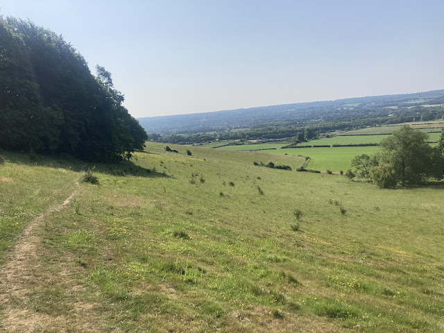
 |
| The fields beyond Otford |
As nice as the village is, it is nice to be back out in the countryside, but this stint through the fields only lasts for so long - and before long we join back up with roads, turning left by a hotel, and then right to follow a busy road up and over above the M25.
 |
| Over the M25 |
Having got inside of the M25 ring, there is still a bit more road walking to be done before we are back into the countryside again. Here there are recent changes to the route, and now the signs encourage you to head up early onto the ridge, taking us off the road earlier than planned.
From here we get some lovely views back at the motorway, but it is not as bad as I make it sound and as we continue on up the ridge we get back into purer countryside.
 |
| Not so bad as you head up into the hills |
Once up on these hills we head into a quiet section of countryside, walking through a mix of fields and woodland as we begin a bit of a lonely trip through the empty space that sits between Sevenoaks and Tatsfield.
As we are high up on the ridge, rather than walking along its edge, we don't have the usual sort of views looking out across the countryside below - instead we are walking through classical agricultural England, only passing the odd other walking along the way.
But we are not entirely alone up here, and when I stop for an early break I soon spot a pair of deer that are fairly undisturbed by my presence, and bouncing around in the fields as I have some early lunch.
Unfortunately though, this stretch is a little forgettable, and there isn't too much more to say about this stretch until the path returns to the southern front of the hills, and as we start coming up to Westerham
 |
| Fields near Westerham |
Here everything starts to change, and this lower section is more what I have come to expect from this trail - and as we head round past Westerham we drop slightly down off the ridge, before heading back into woods on our way back up the ridge.
Back up on the ridge there is another slightly forgettable section along a minor road, before we start bouncing on and off the ridge a few times - with a larger dip down off the ridge just past Titsey Place.
 |
| Dropping off the hills just past Titsey Place |
This once again takes us back into that classic North Downs countryside, and as we head along the base of the ridge this also sees us join up with the Greensand Way - which is coming up from Oxted (with this providing another of the many routes up or down between nearby train stations).
The countryside along this section is really good, but as we join up with the Greensand Way we are also reunited with an old friend in the form of the M25 - and it is here that we get best acquainted with this motorway.
But to be fair, we can put up with the motorway here, because it is really nice walking despite a bit of road noise.
 |
| The pretty countryside |
 |
| Pretty countryside? |
 |
| The latest version of the route map (progress made) |
Further along there is a rather nice bench overlooking the motorway, and I will be honest - I quite enjoy the novelty of stopping off here, particularly since I get to wave at all the drivers as they pass by.
Whilst sat here, I conduct my own informal survey of traffic along this motorway - and I'm happy to report that much of the traffic was actually freight. And if anyone would like to pay me for any follow up reports of traffic along the M25, my fee would be two nights of accommodation in Sevenoaks and Redhill, and a supply of biscuits to munch along the way - travel expenses fully paid please.
Getting back on my feet, it is now time to start climbing up back into the hills - beginning with a sweeping and gradual climb up, before taking on a long series of steps.
Half way up this series of steps there are a set of benches that sit perfectly in line with the train route heading underneath our feet - running through a tunnel that goes from Oxted to Woldingham, and then on up to London.
I take a quick break here, and then continue on up the rest of the steps.
 |
| Starting the climb back onto the hills |
At the top of the steps, there is a pretty section heading round past Winders Hill, before we start to tuck up into the hills - and on through woodland.
Before long, we are cutting up to the north, and the reason for this abrupt change of direction is that we need to get up to a bridge that will take us over the A22 - and with this road crossed, we once again drop down south, continuing on through the trees.
Most of this section here is through woodland, and with it being so hot the shade is very welcome, but even so at this point a drink would be very welcome. Unfortunately, although we have passed near to towns or villages, we haven't actually gone through any of them, and so there have been no easy resupply points on the way (not ideal on a day where you're having to drink quite a lot just to keep refreshed).
However, I do spot a pub coming up very slightly off route as I cross a road near Chaldon, and so here I take the opportunity to get something to drink at The Harrow pub in Chaldon.
One of the flaws with pubs on walking trails is that what I really wanted was a big jug of water, but whilst it is a charming pub it is completely empty when I arrive, and I have to do my best to not offend (an order of tap water at this point would probably not go down well).
In the end I settle on making an order for a pint of water (what I really want) and a pint of coke (what I figure I need to buy). It would have been better if I was able to just pay £5 for a massive jug of water, but I figured this was the easiest thing to do - and not really wanting to stop for long, I'm soon back on my way.
If you are doing the walk from Oxted to Merstham and want somewhere to stop along the way, this is actually a nice place to stop, and not a long trip up from the route of the
North Downs Way.
Back on the path, and after meeting some of the local horses out for a ride, it was time to head down once again - and here there was a motorway special as I managed to tick off a double crossing in quick success - heading first over the M23 and then over the M25, to reach the station at Merstham.
 |
Heading down towards Merstham
|
The plan here is very similar to last night, and I'm heading down on the train into Redhill, where there is a wealth of food and accommodation on offer. Tomorrow I will be back up on the train to continue my walk.
 |
| The latest version of the route map at Merstham |
Total Distance: 19.6 milesTotal Ascent: 2,277 feet
Enjoyment Rating : ⭐⭐⭐⭐ ★ / 5
Disclaimer: This writeup provides a narrative of what to expect rather than a route guide to follow. The route is covered by the 187 and 188 OS Landranger maps - while there is also a North Downs Way guidebook which includes OS mapping (links redirect to Amazon). The route is in general well way-marked.


Comments
Post a Comment