The Pennine Way is the oldest, and one of the more challenging, National Trails - but prior to this walk I had only walked two short stretches - one short section at Hawes, and another where the Pennine Way joins up with Hadrian's Wall above Haltwhistle.
Now felt like the right time to correct my lack of acquaintance with this trail - and so today I am heading out to complete a stretch from Hebden Bridge to Gargrave, and will follow up tomorrow with the section to Horton-in-Ribblesdale.
Although I am doing these walks over two days, you can equally get on and off the trail at Gargrave - and so these walks could be done as solitary days.
The walk from Hebden Bridge up to Gargrave is quite a long way, and so you might prefer to to do it over two days. If you do this, your best bet is probably to stay near Ponden Reservoir - but with long stretches through empty spaces, you probably have to take whatever is available at the time.
But upon my reaching Hebden Bridge, what I find is an old Yorkshire town, with a lot of industrial revolution vibes.
Hebden Bridge is an old weaving town, with plenty of mills powered by the flow of water off the steep hills - and, as you head through Hebden Bridge, you will find plenty of water - both in the streams and canals, and under foot as it heads down off the steep valley sides.
I head out of the station into light rain - out over a bridge, before turning left through a park, to join up with the cycle route that heads out, along Rochdale Canal.
This is a pretty stretch of canal, which includes a number of old barges, with plentiful signs of the old industrial heritage.
 |
| Heading out along the canal |
There is a roughly 1 mile stretch along this canal until I meet up with the
Pennine Way, as it crosses over the canal, on its way past Hebden Bridge.
The
Rochdale Canal itself can be walked between Manchester and Sowerby Bridge (where it joins with the River Calder). It is hard to get much of a feel for how good a walk this might be - this section is certainly enjoyable - but from what I can see I imagine the best section is from Sowerby Bridge round to Littleborough, and this I may look to come back and do one day..
But staying on the
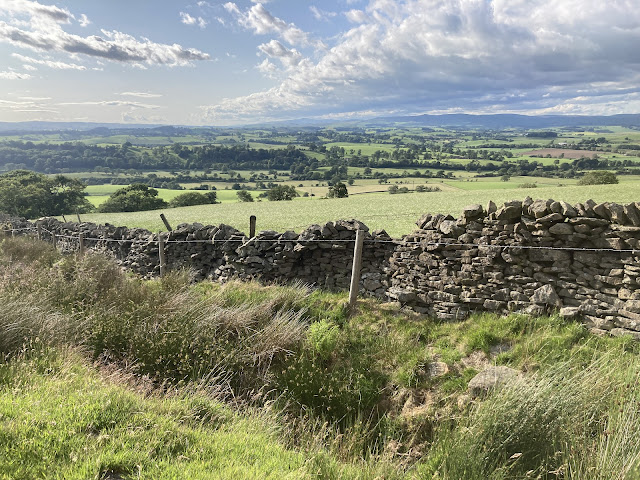
Pennine Way - and turning off to leave behind the
Rochdale Canal - from here there is quite a hefty climb to get through, to get up onto the moors above Hebden Bridge. As you head up you get good views out, over the valley below.
 |
| Looking back across the valley |
From here the path runs up through some smaller villages, on its way up to Heptonstall Moor. If I'm honest, though, this section the most enjoyable of sections - mostly because the path was not that well looked after and quite overgrown. Moreover, after the early rain (now thankfully done for the day), I'm brushing up against wet overgrowth - and the water is pouring down my legs off this undergrowth.
If this does put you off, fear not - for you do have the option here for using the Pennine Bridleway for this section. If you do this, there is a question of where is best to re-unite with the Pennine Way - and I would say the ideal is to rejoin at the village of Colden, but there would be no issue with rejoining just before Gorple Lower Reservoir (it's just a slightly longer walk).
Putting these issues behind as I reach Hepstonstall Moor, the path does improve - and this begins a long (and quiet) section heading north across the moors (I don't actually meet anyone except some cows until Walshaw Dean Reservoirs).
 |
| Just past Colden heading onto Heptonstall Moor |
Here you are crossing marshland, but there are large flagstones providing a dry route across. And these large flagstones are why I mostly walk national trails in new areas - you mostly get these on national trails and they make the walking a million times easier.
Up ahead I spot two groups of cows resting on the path - and with it being marshy on either side, I certainly don't want to go round, and nor do they really - so I hope they are the chilled sorts of cows that won't mind me coming up close as I head past.
As it is - and although there are some calves also having a lie down on the path - we all get along fine, and none of the cows in the groups are at all fussed about my passing - even as I pass close to the resting calves. Instead they all just lazily watch me pass by.
A lot of people are afraid of cows, but it is best to judge them individually by the way they behave. Cows are both curious and anxious - and remind me a lot of large dogs - horses on the other hand I find trickier, and remind me of large cats.
Continuing on - and after completing a long stretch heading north west - Gorple Lower Reservoir comes into view - and here the path turns to the north, as the reservoir-ed section of the route begins.
Here the Pennine Bridleway splits off to follow along the edge of the reservoir - and it is very tempting to head that way, and along the edge of the cool water - but the main route is definitely the way to go - and soon I'm heading alongside Graining Water, in a pretty little cut through the rock.
 |
| Following the path of Graining Water |
With this being a peaceful spot - and with the accompanying sound of the running water - I take the opportunity to stop, and have my first proper rest of the day, sat on a rock watching the water flow by. It's not the worse way to spend a Wednesday morning.
But after having a little rest, it is time to get back on with the business in hand - and as I continue on, the path eventually pulls up off the path of the stream, to join up with a very minor road - and then cuts east along a farm track, to join up with Walshaw Dean Lower Reservoir.
Crossing over the head of the reservoir, and then walking alongside it, I walk on to reach Walshaw Dean Middle Reservoir - although I'm sad to say that this path will never reach Walshaw Dean Upper Reservoir, and so you will not get the chance here to complete the full Walshaw Dean Reservoir set, without going off route.
 |
| Walshaw Dean Middle Reservoir |
As we pass the reservoirs, it is important to keep an eye on where you are stepping - as on the way past, there are streams coming down from the hills, and when these cross the path, there is a little jump in the path that can be easy to miss. These require a step over a short gap, which has a reasonable drop down - and so you ideally don't want to step into these.
But having safely navigated past these dangers, the path heads up on a long climb, up above the reservoir, to then rise up nearly to the top of Withins Height.
It is here that you start seeing more people - and suddenly a load of signs talking about the Bronte sisters, who grew up in Thornton (near Bradford) - but later lived in Haworth (which lies just to the east of Ponden Reservoir up ahead).
The Bronte sisters seem to be the big tourist draw for the area, and the ruin ahead at Withins Height is bizarrely famous for "probably not" being the inspiration for Wuthering Heights. Indeed the sign says :
This farmhouse has been associated with "Wuthering Heights", the Earnshaw home in Emily Brontë's novel. The buildings, even when complete, bore no resemblance to the house she described, but the situation may have been in her mind when she wrote of the moorland setting of the Heights.
This doesn't exactly read as a glowing endorsement of the idea that this might be the inspiration for Wuthering Heights, but other parts of the internet proclaim this to be the case - and the house seems to be getting plenty of visitors nevertheless.
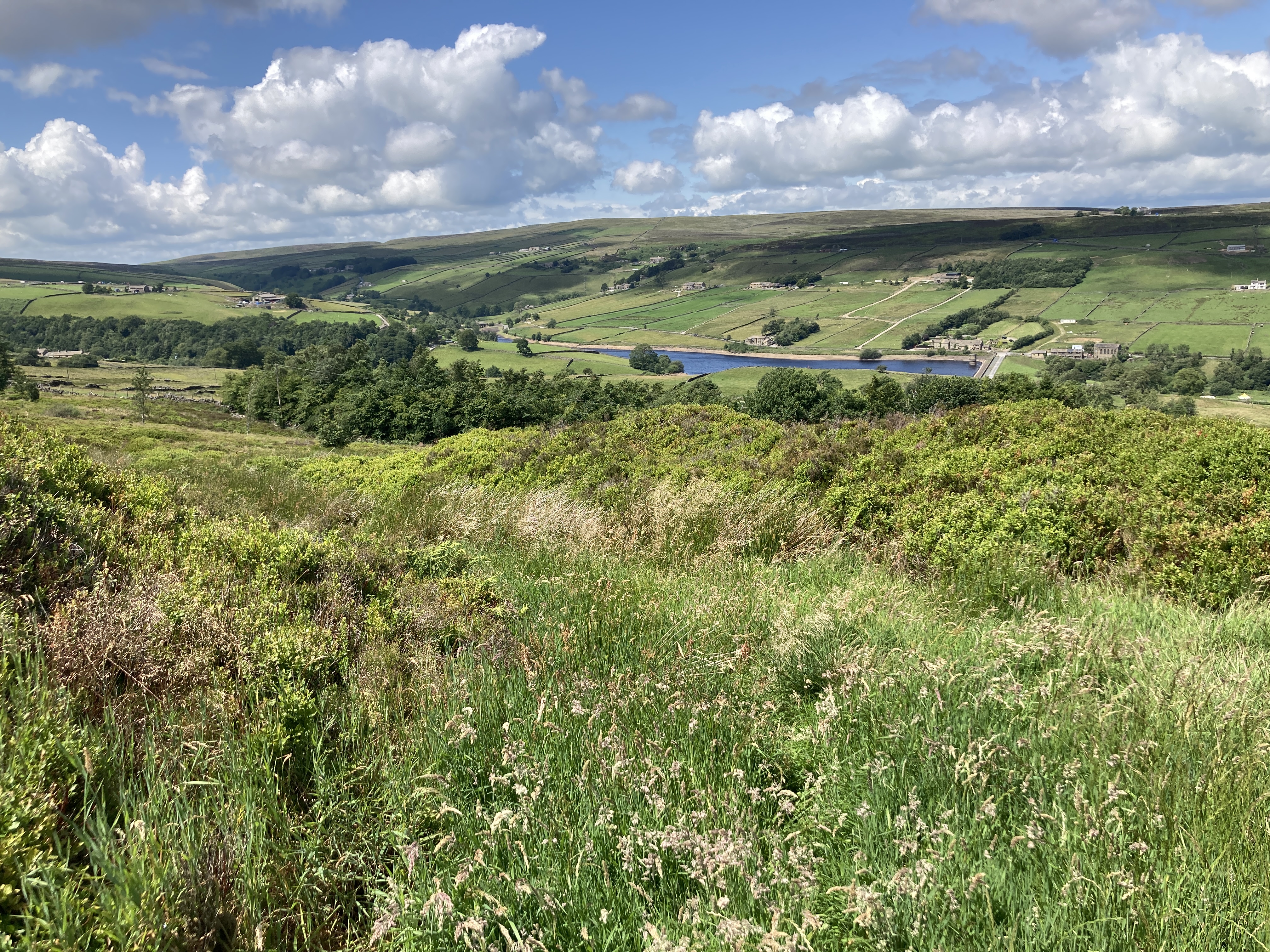
As it is though, this is a pretty spot - and although it is open moorland, it isn't particularly wild - indeed it is pretty delightful to walk through, and from here the path heads on, and begins to slowly descend down towards Ponden Reservoir.
 |
| Looking out towards Ponden Reservoir |
Here the area has a very touristy (and well-off) feel - and as we drop down to the side of Ponden Reservoir, the miles of deserted moorland crossed in order to get here, become a memory, as we pass numerous walkers walking around the reservoir.
If you want a mid-point of this walk to use as a staying over point, I think this is the perfect spot to look. It has a lot more people than the near-empty countryside we have passed - and it wouldn't be a bad place to come to a lazy halt, before heading off to find your accommodation.
An additional option is to extend your walk out to Haworth - where you will presumably see a lot more history of the Bronte sisters - and that is a town where there are plenty of places to stay.
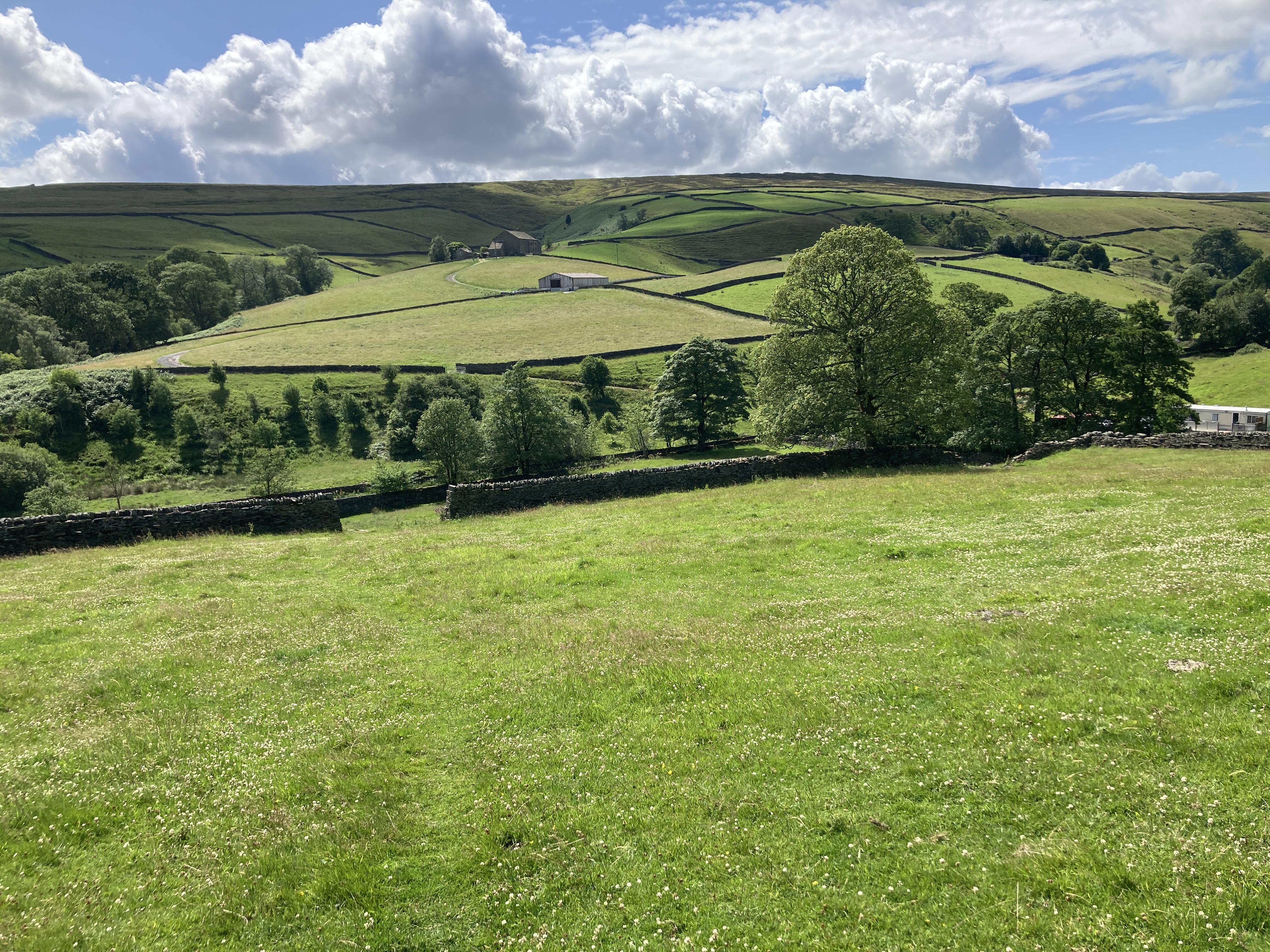
But for us, we still have a long way left to go on this walk, and we head round the reservoir, and then start to climb up the reasonably steep slopes of the fields on the far side - heading up onto Oakworth Moor.
 |
| Leaving Behind Ponden Reservoir |
 |
| Heading up through the fields |
At the top of this slope, there is a bit of a soggy cut that we follow - to join up with a minor road - where I generally do well to avoid the mud, before sticking one foot deep into a very smelly puddle. But, having cleaned up my shoes, I join up with that road, head along, and then continue to gain height, following a path up on the far side.
Here we begin a long, and very quiet, section (and indeed make it round to Lothersdale before we meet another walker).
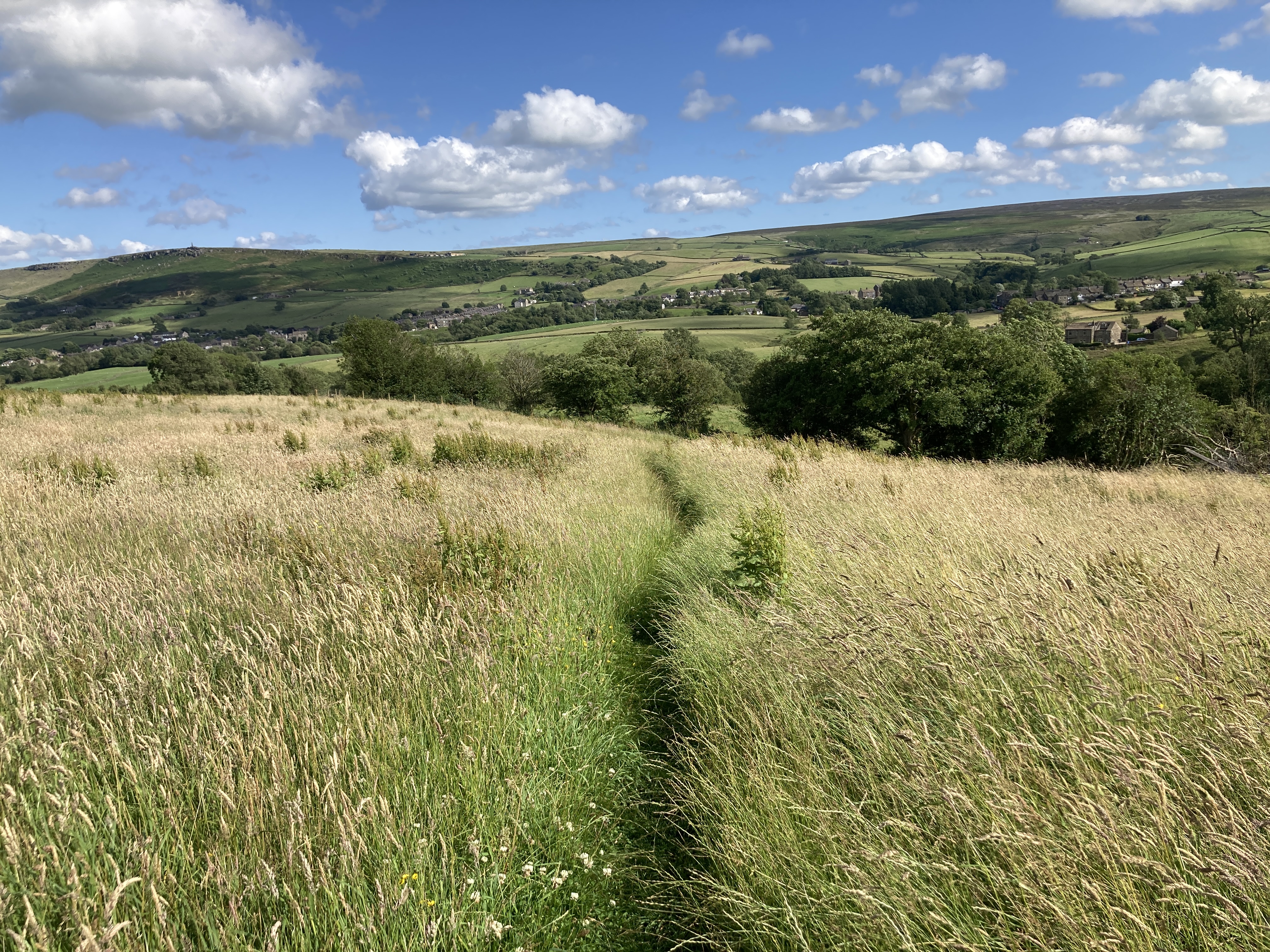
The first part of this section, is a long stretch gaining further height, heading up Oakworth Moor to Bare Hill. Ahead you can see the Wolf Stones on the peak of the hill, but before these are reached the path pulls to the right, and takes you on through Ickornshaw Moor.
Having finally crested the ridge, what follows is a long downward section, that takes you on a meandering downward descent into Cowling - where you take a few turns around the houses, and a few more round the fields, before once again heading up on a climb.
 |
| Looking back towards Cowling |
Having made it through the fields - and past a number of inquisitive cows - the path joins up with a minor road, before turning off to head towards Lothersdale. Here a bench provides a welcome break, before the path heads down into the town.
 |
| Looking out over Lothersdale |
This again would provide a nice place to stay - but all the same, I didn't see anywhere to stay here. And the previous village of Cowling is probably the better alternative if you want to break up this section further along from Ponden Reservoir. From here there is also a sort-of-close rail link at Conoley.
Having once again dipped down and back up the other side (there are quite a lot of hills on the
Pennine Way by the way!), I am now following a couple, who appear to be out for an evening walk - and I can now use them to help guide me along the path, trusting that they should be going in the same direction as I plan to go.
 |
| Looking back from the other side of Lothersdale |
This section is notable as the last major climb of the day (and a fairly hefty one at that), and once the path turns to the west, the path finally heads up to its high point on Elslack Moor.
 |
| Looking out from Elslack Moor |
After reaching the high point, the path then dips down to a road - where things get busier, as here lies a car park, busy with cars eagerly waiting for their owners to get back from their walks.
Upon reaching the car park, the path follows a minor road, before turning off to the left, and starting a long descent down into Thornton-in-Craven.
 |
| At the start of the descent down into Thornton-in-Craven |
Prior to reaching Thornton-in-Craven, we head over a Roman Road that once ran from Ribchester (near Preston and Blackburn) to York, via Ilkley.
Slightly up this Roman Road (turning right), was Elslack Roman fort, or Burwen Castle, for which only the original layout is visible today - and only really from above. This was the site of two forts, one dating back to 70-80 AD - which makes it quite an early Roman fort - and a second larger fort dating to 210 AD.
But here we are also crossing the path of a disused railway line - which we head under at Elslack Bridge - which generally follows the route of that Roman Road, and which cuts straight through the forts mentioned above.
This railway line ran between Skipton and Colne (via Earby) and opened in 1848 - with stations being located at Elslack, Thornton-in-Craven, Earlby and Foulridge.
And the railway did in fact avoid a recommendation for closer in Beeching's infamous The Reshaping of British Railways - which killed a lot of the old train lines in Britain. Instead the line closed in 1970 - but there is a campaign to get it reopened, with the campaign highlighting that there is only about twelve miles of missing track.
This addition would connect Skipton up to the route on through Burnley and Blackburn to Preston (where it would meet the West Coast Mainline), and a study has confirmed that there are no major engineering challenges to reopening.
A government study then declared the project 'technically feasible', but there was not been too much movement until recently, where it has been boosted by the higher than expected success of recent railway re-openings. And indeed, it seems like this line will reopen eventually (and so maybe us walkers will get an extra rail link here at Thornton-in-Craven.
Having walked through Thornton-in-Craven, from here the rest of the walk into Gargrave will be fairly flat - which is welcome because by this point it has definitely been a long day of walking.
And after heading out along farm tracks, and then through the fields, the path joins up with the
Livepool & Leeds Canal.
 |
| Leeds and Liverpool Canal |
And of the sights I have seen on this walk the two that have most peaked by interests have been the two canals (at the start and end of this walk).
This canal runs for 126 miles from Leeds to Liverpool (the clue is in the name), and there is something about it that makes me want to come back and walk more of it (maybe all the hill walking is increasingly the appeal of a flat trail).
Along with the Huddersfield Narrow Canal and the
Rochdale Canal, this canal provided a route across the Pennines - but whilst those routes were more direct (with an awful lot of locks along the way), this route was much gentler.
And in combination with the Aire & Calder Navigation, this eventually provided a coast to coast route between the Irish Sea and North Sea (after an extension to Stanley Dock in Liverpool in 1846).
This was a very successful canal, and it was designed to accommodate 'short boats', which can each carry 45 tons of goods - twice that of a standard narrowboat.
The canal mostly moved coal, but would carry a lot more besides - and remained operational as a key transport route until the 1950s, with large loads continuing until the early 1980s - delivering it's last barge of coal to Wigan Power Station in 1972.
This was despite the competition provided by the nearby railway - which the canal was unusually able to compete with.
These days the canal is mostly used for pleasure boating, cycling and walking, and it is will maintained by the Canal & River Trust who do great work along these canals to make them enjoyable places to be.
But we are soon leaving behind this canal, and the path turns off to head through the fields - and it feels a shame to be leaving the canal behind,as it has provided some contrast to the day.
And indeed you could simply follow the canal from here into Gargrave, but being a purist at heart, I stick to the official trail - although I'm still sure that the canal would have been the more enjoyable walking option.
Eventually though, we arrive in Gargrave, to end a long, but enjoyable day.
Total Distance: 28.3 miles (26.6 miles on the Pennine Way)
Total Ascent: 4,652 feet (4,580 feet on the Pennine Way)
Enjoyment Rating : ⭐⭐⭐⭐⭐ / 5


Comments
Post a Comment