This walk marks the last of a three day walk along the eastern section of the North Downs Way, walking from Canterbury to Dover. On the previous day I had walked from Harrietsham to Canterbury.
Having stayed overnight in Canterbury, I was staying a skip and a jump away from the route of the North Downs Way - and so I was able to immediately reunite with the path after leaving my hotel.
My first task of the day was to head out of Canterbury, which meant getting through all the school traffic and kids walking to school - before heading out on a quiet farm track, heading out of Canterbury to Patrixbourne.
Just before Patrixbourne, the route passes close by a train station at Bekesbourne - and this offers an alternative route on and off the North Downs Way for those looking to do the walk in sections.
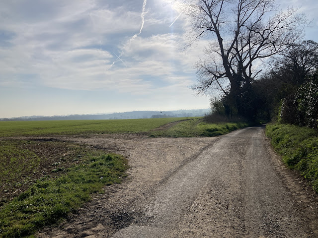 |
| Heading out of Canterbury |
At Patrixbourne, we find ourselves back in the countryside, but not entirely away from the morning commute - and as we head through this village, we do have to watch out for some of the more impatient commuters - who seem to be trying to set a new personal best as they drive through the village.
Speculating over whether these drivers are simply setting qualifying times for the upcoming race - presumably held later in the day on their way home - or are just very impatient people, we continue on through the village.
But on the blind bends I did find it best to stand to one side when I heard the cars coming as, and I would encourage caution for anyone walking through the village in the morning - and this extra bit of caution and patience on my part did avoid a few near misses along the way.
Aside from the maniacs on the road, Patrixbourne is a very pretty village - albeit with the vibe of a place where people are likely to disappear off to London during the week, and then have quiet time at home over the weekend.
 |
| The church at Patrixbourne |
But after passing through the village, the path mercifully diverts away from the road, and here there are more people out and about - either for dog walks, cycles or morning runs.
Continuing on up the track our path takes us up to run parallel to the A2, but although this looks unpromising on the map, there are plenty of trees blocking off the road, which do their best to keep the going pleasant. Then once we get past the farm on the left, the path starts to drift leftwards away from the A2, as we begin to head through a quiet section of fields.
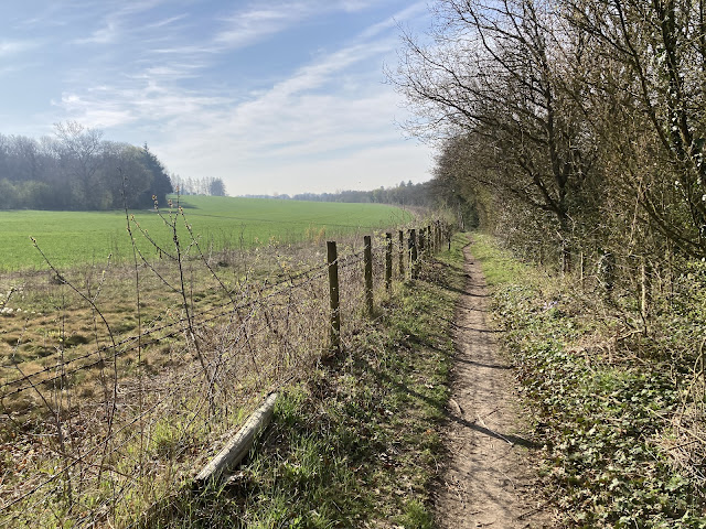 |
| About to drift right and leave the A2 behind |
This next section offers up, what I term 'standard countryside' - the default sort of thing you see across the country, and where most people go for their local walks - and whilst not unpleasant is not particularly spectacular either.
Still it is an enjoyable wander - and whilst not quite as good as the previous days, I am still enjoying this section of walking.
 |
| The pretty standard countryside passing Womenswold |
After a certain amount of traipsing across fields, we pass through Womenswold and then come to Woolage Village, where there is a big park that offers up a good spot to have some early food - or if the mood has really caught you, a chance to have a play on the swings.
By this point we are well on our way towards Dover - and as we continue on through the fields of Kent we are now well used to the pattern of the day, using the fields to pass from village to village.
And not too much further along the path, after passing over a railway line via a minor road - we head into the next village of Shepherdswell.
Here the path heads through the very centre of the village - passing between fields of horses on either side of the path.
There is a lovely feel to this village, and so at some benches on the far side I make the decision to have my first break of the day - noting that next we will be heading on towards Whitwell, after which we will be very much on the outskirts of Dover.
With that break over, we head on out the village - and back into the usual chalky countryside.
 |
| Proof of 'the usual chalky countryside' |
The walking has been pretty flat all day, with no real ridges or dramatic countryside to overcome - but so far it has felt like a pleasant and pretty chilled end to these three days of walking.
But just as I start getting used to this pattern of fields and small villages, the path enters the grounds of Waldershare House - which is a monster of a house that sits slightly awkwardly in the open countryside.
The estate itself is again pleasant to walk through, and it is a proper country manor - with numerous estate cottages. And whilst the house itself doesn't have much of a lived in feel (and instead feels more like a monument to a former time), the surrounding cottages do all look very homely.
 |
| A seat at Wandershare Estate |
On the way out of the estate, we next pass a small church that whilst slightly modest - and perhaps a bit ugly on the outside - nevertheless has some pretty features once you take a bit of a closer look.
And after passing this church, the route now joins up with some minor road, which help take us over the A256. Here we are starting to leave rural Kent behind, and gradually reintroducing ourselves to the busy modern world.
Indeed the next village we pass through - Ashley - is a more modern affair - but after passing through this village, we do return to slightly more classical Kentish countryside.
 |
| Beginning to head south towards Dover |
 |
| Slightly further along |
This next section of path continues to be as pleasant as it is unspectacular - and this general vibe continues until we once again start seeing signs of more urban life, as we begin to pass Whitfield.
At this point we are following the path of an old Roman Road - following a road that would have connected up Dover and Richborough (near Sandwich).
But as we draw level with Whitfield, our progress comes to a bit of a halt, because there is no direct crossing over the A2 along this route any more - with the old crossing having been closed off once the road became too busy for pedestrians to scurry over.
Instead we have to turn left to follow the A2 for about a third of a mile to a bridge, and then having crossed over this bridge, we head back for another third of a mile, to rejoin the original route on the far side of the road.
Here we resume our journey along the old Roman Road - and with this diversion now cleared, it is a fairly straight run from here into Dover.
For now we continues on along tracks, but eventually we find ourselves walking along a fairly quiet road that drops down fairly steeply.
At this point I was expecting some sea views as Dover came into view - as would be typical of a route finishing by the seaside - but in reality, and slightly surprisingly, you don't really get much of a glimpse of Dover, or the sea, along the way.
But then as we arrive in Dover itself, and navigate through Connaught Park, we do get our first sight of the town.
Now that we are here, it has maybe been fortunate that we haven't had too much of a sight of the town.
Dover Castle is pretty majestic as it looms over the surrounding area, but Dover has a bit of a down on it's luck vibe to it (although this may in part stem from my fear of the schoolkids, who are passing by on their way home).
Unfortunately you can't really just pop into the castle on your way through, as it sits about half a mile to the side of our route - and sits on a ridge lying well above the rest of the town.
Unless you have the spare time and energy to make a trip over, the castle is probably a sight for another day - and indeed I do the bare minimum of getting into Dover, and heading over to the station to catch my train home.
Total Distance : 19.2 miles (18.9 miles on the North Downs Way)
Total Ascent : 1,421ft
Enjoyment Rating : ⭐⭐⭐ ★ ★ / 5
UPDATE - click to see the writeup for a follow up walk when I also headed out from Rochester but walking in the opposite direction, going from
Rochester to Farnham to complete the
North Downs Way in the opposite direction.
Disclaimer: This writeup provides a narrative of what to expect rather than a route guide to follow. The route is covered by the 179 OS Landranger map - while there is also a North Downs Way guidebook which includes OS mapping (links redirect to Amazon). The route is in general well way-marked.


Comments
Post a Comment