Thames Path - Hampton Court to Richmond (★★★☆☆)
This is a fairly section on the Thames Path - running from Hampton Court up to Richmond - with this joining up with a route walked previously from Battersea to Richmond.
And upon reaching Hampton Court station we head out and almost immediately rejoin the edge of the river - and here we pass over Hampton Court Bridge, and meet up with Hampton Court Palace.
 |
| Hampton Court Palace |
Hampton Court is one of those sights you are most likely to be tempted to visit along the river (and you can get a palaces ticket that combines with access to the Tower of London (also along the Thames Path in central London).
The palace did not begin as a royal residence, but instead was built by Cardinal Wolsey - and then given to the king as a gift (that would hopefully bring him enough back into favor to stay alive).
Having been gifted the palace, this went on to become one of Henry VIII's favored residences - and he enlarged it to suit his purposes.
More substantial expansion followed in the 1690s during William II's reign - and it was his intent to turn this into a palace to rival Versailles.
The palace itself is both huge and ornate - and it probably is one of the few sites I'd recommend for a visit.
But I'm not going in today, and so instead have to peer in from behind the locked gates, as I head past:
The best photo opportunity comes as you head past the palace itself - and here you just have to head towards the palace as far as you are allowed - and you can then get a shot of the front from a distance.
 |
| The view looking down the river |
But it's not all about the palace here - and it is a very pleasant river to walk along, with plenty of people out enjoying this stretch - either on foot, running, or by bike. The joggers and bikes in general take the higher route, but we take the lower path by the river side (which is quieter).
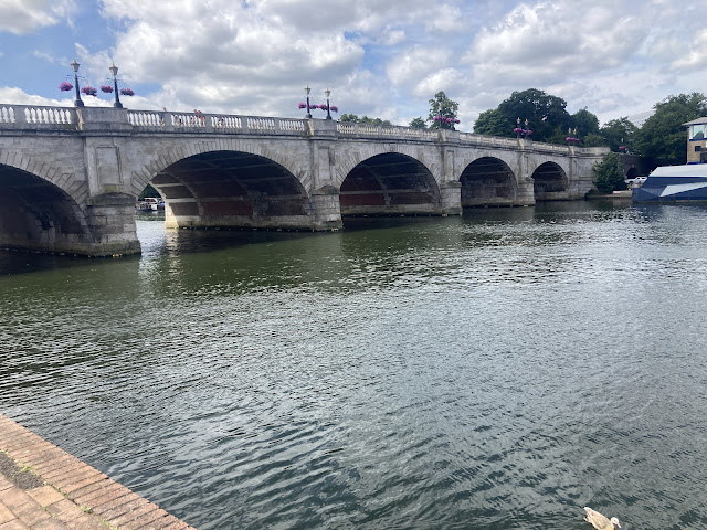
Heading on, the path here heads south east, before turn to head north east, and then directly north - as it heads up towards Kingston Bridge.
 |
| Kingston Bridge |
Here the path crosses over the bridge, and continues on the other side of the river.
 |
| Cossing Kingston Bridge |
 |
| Back towards Kingston Bridge |
From the far side, the route ahead continues on through Canbury Gardens - which is a busy (and fairly small) park alongside the river. And here I stop to have some food and drink on one of the numerous benches.
After getting going again, we leave this park behind - and from here the path follows along a quite road, before crossing over, and heading along a small stretch of green land - between the houses to the right and the river to the left.
Following this round, the path soon reaches Teddington Lock - which is a large lock and an interesting site to hang around, and watch some of the boats head through. Unlike most locks it is controlled by a man with a control panel, so there isn't the usual possibility of things going awry, but there is some entertainment to be had here all the same.
 |
| Teddington Lock |
Next, the path continues along on the edge of Ham Lands Nature Reserve - and for this stretch, the path heads through woods, and there isn't too much to be seen either inland or out across the river.
This does lessen the enjoyment somewhat, and there are also a few bikes to dodge, both from in front and from behind - but it is still a fairly pleasant walk.
Eventually we head past Eel Pie Island (which you get a few glimpses of through the trees), and then it is not too long though before the route opens out - and we get a much nicer route for walking as we pass Ham House to the right.
This is a National Trust property - and from here lots of walking routes branch out across the grounds of this house, all done to the usual high National Trust standard.
And indeed, these walks look very attractive - and in general the area around Richmond is very well finished - with lots of clear trails and nice countryside to look about at again.
But as we pass the ferry crossing across the Thames (heading across to Marble Hill House), my route heads on - and with a left bend into a very busy Richmond this stretch is complete.
It is exceptionally busy today, so I take a bit of a back route round to the station - before heading to my train.
Total Distance: 7.9 miles (7.4 miles on the Thames Path)
Total Ascent: 116 feet (89 feet on the Thames Path)
Enjoyment Rating : ⭐⭐⭐ ★ ★ / 5
Click for the writeup of the next section along the Thames Path from Kingston to Weybridge.
Disclaimer: This writeup provides a narrative of what to expect rather than a route guide to follow. The route is covered by the 176 OS Landranger map - while there is also a Thames Path guidebook which includes OS mapping (links redirect to Amazon). The route is in general well way-marked.

Comments
Post a Comment