Having grown up in Guildford, I ended up doing a lot of walking along the Surrey Hills in my youth - and quite a bit of this walking would be along the route of the North Downs Way.
But despite this being a National Trail that I know really well, I haven't actually walked very much of it - having only walked along the section between the River Wey in Guildford and Reigate Hill. And even on this section, there are gaps in the trail which I have never walked before.
This year I am planning to walk the entire length of the North Downs Way - and noting the two alternate routes, have decided to walk the section that heads through Canterbury on the way down to Dover.
Realising that I have not done a whole lot of multi-day walking in recent years, I am not going to be too ambitious, and instead plan to split the walk in two at Rochester.
Rochester itself offers a nice point along the trail to make this split. It sits roughly half way along the length of the trail, whilst also having very convenient public transport links for those of us (like myself) based in the north of England.
But whilst HS1 offers a very quick link down from St Pancras to Rochester, my plan today is to get as close to Ashford before the sun sets (we are just past the clock change, making things a little easier, but still quite early in the year) - and so I'm heading out of Darlington at a slightly ridiculous hour, on the 6:31 train to Kings Cross.
But the genius of this plan quickly becomes apparent, as I head over to St Pancras and hop onto the 9:50 train - getting me into Rochester, and on my way, at 10:27. It's been just under four hours after leaving Darlington station, and I'm already walking.
The train journey itself from Rochester was not exactly pretty - and in all honesty this train line heads through some of the very ugliest parts of England - but it is at Rochester where the scenery starts to improve.
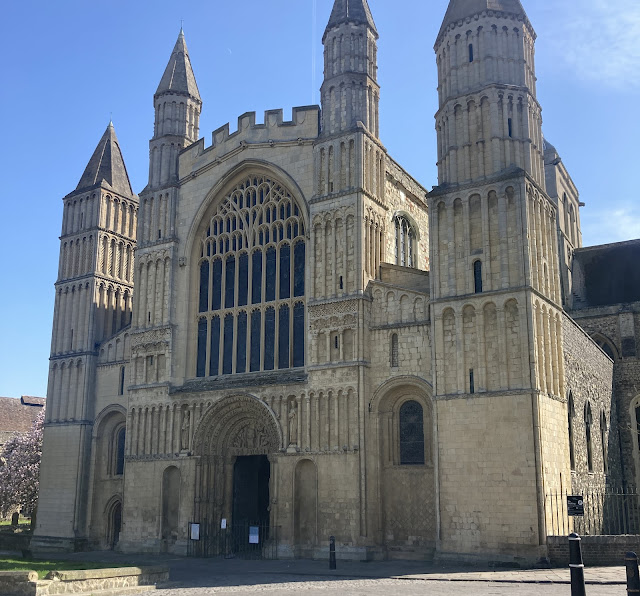 |
| The cathedral in Rochester |
Getting off the train, and heading off through Rochester - I cross over the fairly medieval looking High Street, and then on past the castle and cathedral - before walking through the outskirts of Rochester, to meet up with the
North Downs Way - as it passes under the M2.
This walk through Rochester isn't an unpleasant walk (it is about 2 miles from the train station to the
North Downs Way itself), and having passed under the M2, Rochester is left behind and ahead lies open countryside.
Initially we turn off to the left along a quiet road running parallel to the motorway - but it is not long before we are turning right at a farm, to begin a climb up into the hills.
Once a bit of height has been gained, it is possible to look back towards Rochester - which is a view that is unfortunately dominated by the passage of the M2 and the Eurostar (you will almost certainly get to watch a few trains on this walk).
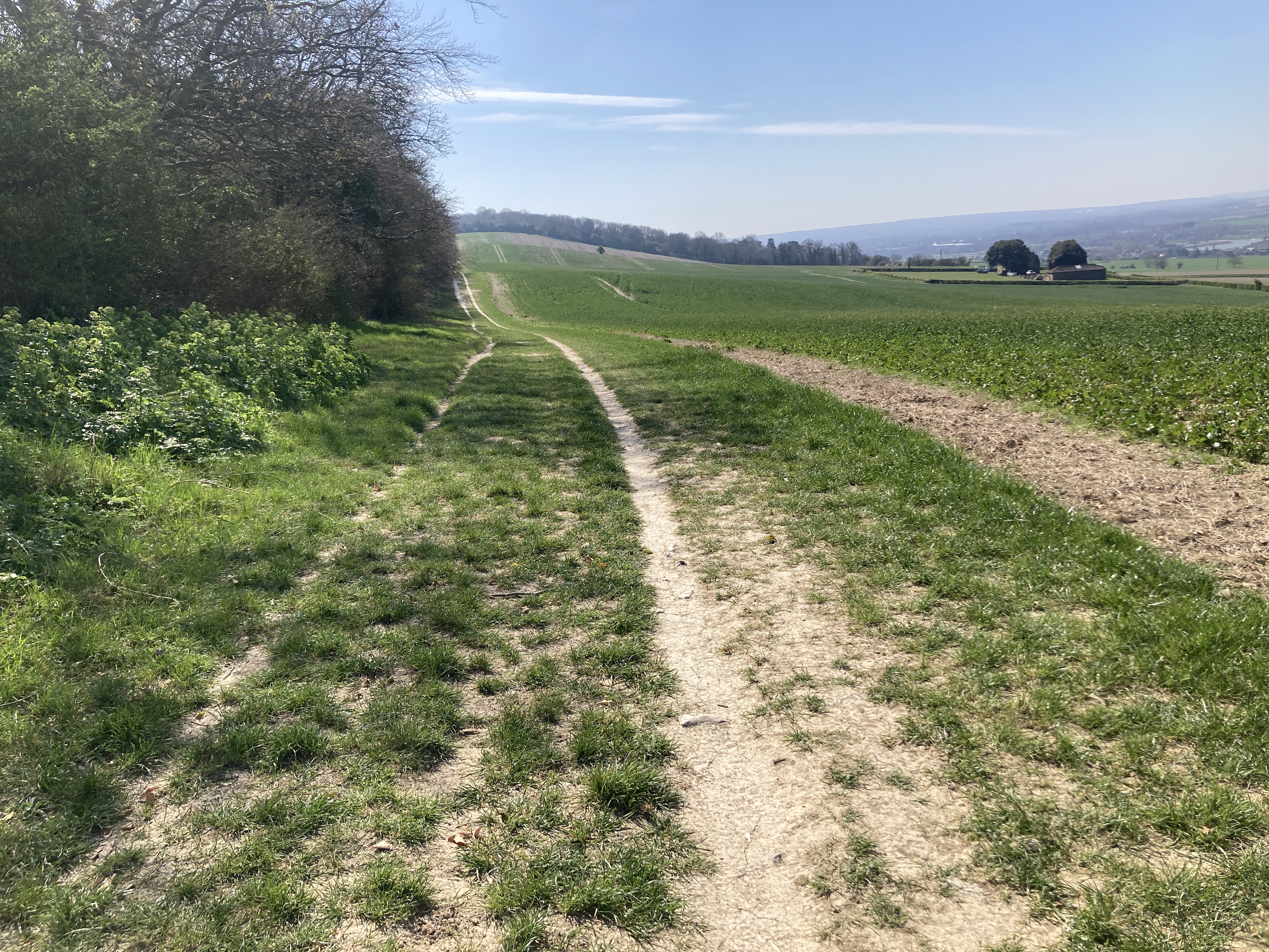
But turning back round, ahead of us lies an agricultural and chalky route which is more what we came here to see :
 |
| The start of the walk along the North Downs Way |
And from here the motorway quickly becomes a mere memory, as we head out through the fields. Eventually this path turns into a farm track, and then into a very minor road that remains pleasant to stroll along.
But then things do liven up again as we meet up with the A229, and cross some busier roads, but although we find ourselves following the A229 along the next section of the trail, we do get a little treat to make it all worthwhile - as we meet up with the oldest historical site along the
North Downs Way :
 |
| Kit's Coty House Burial Chamber |
These stones might not be as spectacular as Stonehenge, but they are much older - and this monument dates back to around 4000BCE, in the Early Neolithic period.
Indeed if we were to get ourselves a time machine and turn the clock backs by the same amount of time between the construction of this monument and the main stone circle at Stonehenge, we would find ourselves in Roman Britain right now.
Without there being a car park or visitor centre, this monument is allowed to enjoy the quiet of the countryside - but for us it is very convenient, as it sits only a few meters off the route of the
North Downs Way.
Continuing on, I decide to skip the less well preserved site at Little Kit's Coty - which is in more of a ruined state, and a bit further off the path - and instead continue on as the path heads back towards the A229 - which we then pass under, before we head over the path of the Eurostar.
From here it is once again time to go on a bit of a climb, and next we head up through Westfield Wood - and whilst I generally prefer the open ridges over woodland, this is a very pleasant and enjoyable wood to walk through.
 |
| Westfield Wood |
After completing quite a long climb, we eventually pop out into the fields on the far side of the hill, and from here we spend our time popping in and out of the woods as we head on towards the village of Detling.
As we start to close in on Detling, it is time to drop down off the ridge - and as we pass through Detling we head over a bridge that crosses the A249. I may be wrong, and it may be common for them to transport the Cuty Sark underneath this bridge, but as a bridge it feels to have been somewhat over-sized - and it's a bit of a climb just to get over the road.
But having made it across to the far side, we soon find ourselves on the opposite side of Detling, and heading out into the prettiest countryside that we have encountered so far.
From Detling it is possible to head across to Bearsted train station via the footpaths - and that train station is certainly not a bad spot from which to join this trail.
But continuing on along our path, we head up onto the ridge to begin a stretch that offers a perfect end to this first day of walking.
 |
| Having climbed up from Detling |
 |
| Continuing along the ridge |
Having made it up onto the ridge, the route continues to offer up great views along the ridge. While heading along the ridge, walking can get slightly tricky in places as you are often walking along a path that slopes down from left to right, but the views are more than good enough to make up for this slight inconvenience.
But whilst the path is kind enough to generally stay at a consistent height, there are still a few steep ups and downs along the way.
 |
| The path ahead on the left generally holding level on the ridge |
This stretch of ridge walking runs for about five miles from Detling round to Hollingbourne and is one of the prettiest sections of the entire
North Downs Way.
Whilst we have been walking up on the ridge along this section, a road has been running along the base of the valley, along the route of the Pilgrim's Way trackway - and at Hollingbourne we drop down onto this trackway as it turns into a farm track running along the base of the valley.
And here, with the light fading at the end of the day, we head on through pretty fields to meet up with a path that heads south and straight onto the platform at Harrietsham train station.
The first half of the day, walking from Rochester to Detling was a pleasant enough, but not wholly spectacular, walk - but from Detling onward it has been a truly wonderful stretch of countryside to walk through.
My plan for the evening is to head into Ashford by train - from which it is easy to get food and accommodation.
For a more authentic experience there are places to stay in Hollingbourne and Lenham, but on this walk I leave these pretty little villages behind - and head off to Ashford.
Total Distance : 19.2 miles (of which 16.7 miles were on the North Downs Way)
Total Ascent : 2,503ft (of which 2,329ft were on the North Down Way)
Enjoyment Rating : ⭐⭐⭐⭐ ★ / 5
UPDATE - Click
here for a writeup of the walk heading in the opposite direction from Rochester to Farnham along the North Downs Way.
Disclaimer: This writeup provides a narrative of what to expect rather than a route guide to follow. The route is covered by the 178 and 189 (minimal time on this map) OS Landranger maps - while there is also a North Downs Way guidebook which includes OS mapping (links redirect to Amazon). The route is in general well way-marked.


Comments
Post a Comment